Today’s post comes from Evan McCaul, assistant superintendent at Wabakimi Provincial Park.
Welcome all new and returning visitors to Wabakimi!
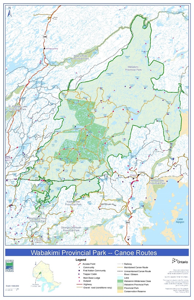
Located a three hour drive north of Thunder Bay, Wabakimi is a huge sweep of the Canadian Shield, encompassing over 1,500 km of canoe routes. This park is a hub for exciting paddling experiences and adventures!
Check out the following top five pointers to assist with your backcountry trip planning:
1. Know your options for accessing the park
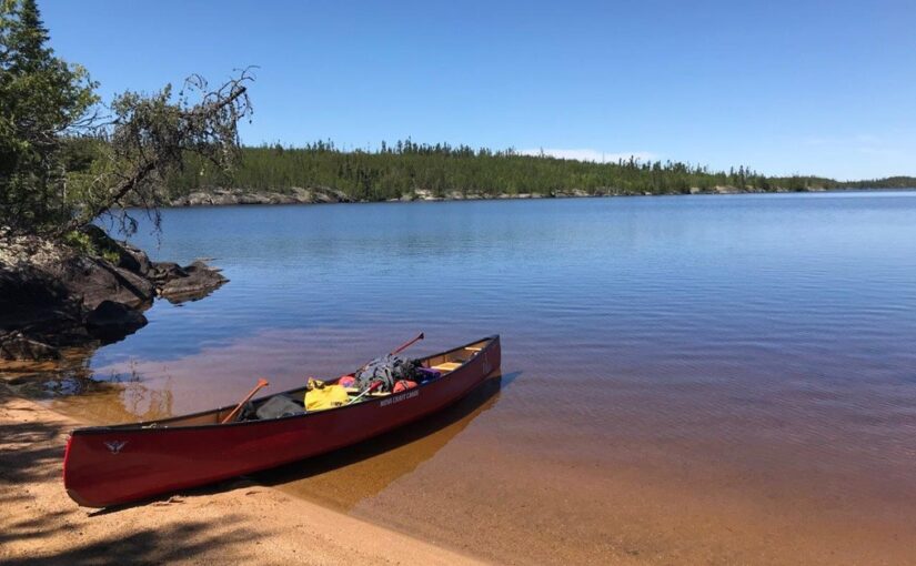
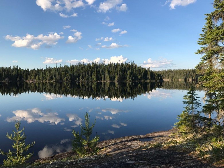
Camping in Wabakimi Provincial Park is a remote backcountry experience which requires careful planning and an intermediate to advance level of tripping skills.
There are no park facilities or roads within the park.
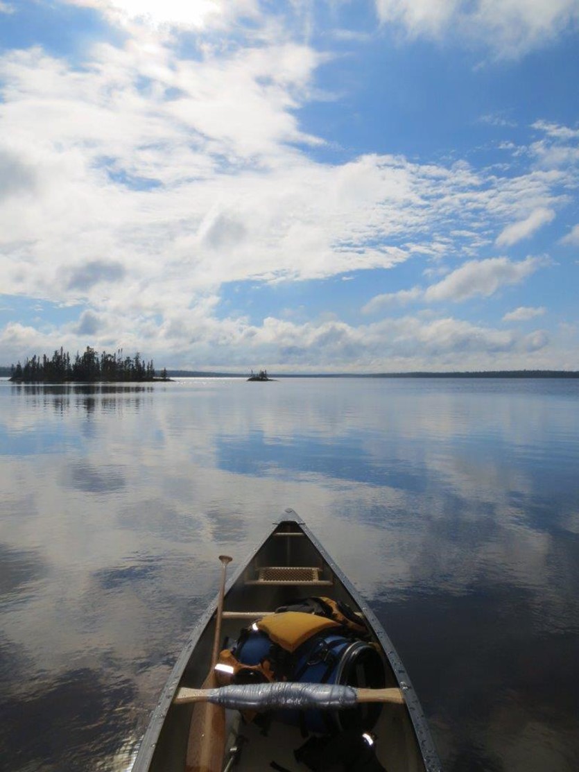
Visitors can access the park by canoe, train, or plane. Often times paddlers will take one mode of transportation into the park and another out to facilitate a linear route trip option.
Access by canoe
From Armstrong area: Trail Lake Road, Caribou Lake Road, and Pikitigushi Lake provides access into waterways that connect to Wabakimi. Obonga Lake Road gives access into Kopka River Provincial Park which adjoins Wabakimi.
From Upsala: The Graham Road gives access into Brightsand River Provincial Park which connects to Wabakimi.
From Savant Lake: Road 702 and the Vista Road have access points allowing canoeists to paddle into Wabakimi Provincial Park.
Access by rail
A Via Rail line runs across the southern portion of the park. Trains run through Wabakimi certain days of the week, which vary depending on their direction of travel.
With reservations and 48 hours’ notice, Via Rail will drop off / pick up canoeists at “special stops” or mile posts in the park. When making a reservation, Via wants destination details (mile posts) and if you have a canoe, as fees apply.
Don’t expect the agent to know the details about the park; you knowing the closest scheduled stop location and mile posts will help them a great deal.
Tip: Your backcountry trip starts as soon as you step off the train. Expect nothing more than an unmarked portage trail leading to the lake at these train stops.
Check online for updated Via Rail schedules:
Tip: The train has a limited cargo capacity for canoes. You will need to confirm with Via Rail that there is baggage space on board in advance.
| Mileage Stop | Name | Site Description |
| 17.0 | Canon Lake | Remote stop. Used to access Tamarack Lake. No campsite at this location. |
| 20.2 | Collins | Collins is a community and a regular stop. Stop is on private property, please call ahead for camping. |
| 24.7 | Schult’s Trail | Access to Onamakawash Lake. Follow trail from tracks to camping area. |
| 32.3 | Alderidge Creek (flows from Beagle Lake) | Remote stop, limited camping. North to Lookout River. South to Alderidge Lake. Canoe travel required to access campsite. |
| 34.4 | Lookout River | Lookout River (or at bridge) mile post 34.4. |
| 37.4 | Baldhead Lake | North to Ballast Creek, east to Lookout River. Canoe travel required to access first campsite. |
| 44.1 | Redhead Lake | Private camp at 44.1 — do not camp. |
| 44.4 | Readhead Lake West | West side of bridge just past signal light, trail leads to new camping area established by park staff in 2012. |
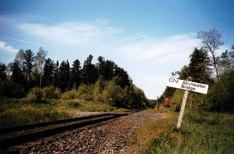
| 54.6 | Allanwater Bridge | Two commercial camps; camping and lodging available. Please call Allanwater Bridge Lodge or Wabakimi Fishing and Canoeing Outfitters. |
| 62.5 | Barrington Lake | Commercial camp; fees may apply. Please call Barrington Lake Camp. |
| 67.1 | Flindt Landing Camp | Access to Heathcote Lake. Camping is limited and there may be a fee to launch a canoe. Contact Flindt Landing Camp. |
| 67.3 | Heathcote Lake | Just past causeway on west shore. Steep trail, follow portage north to campsite. |
Access by air
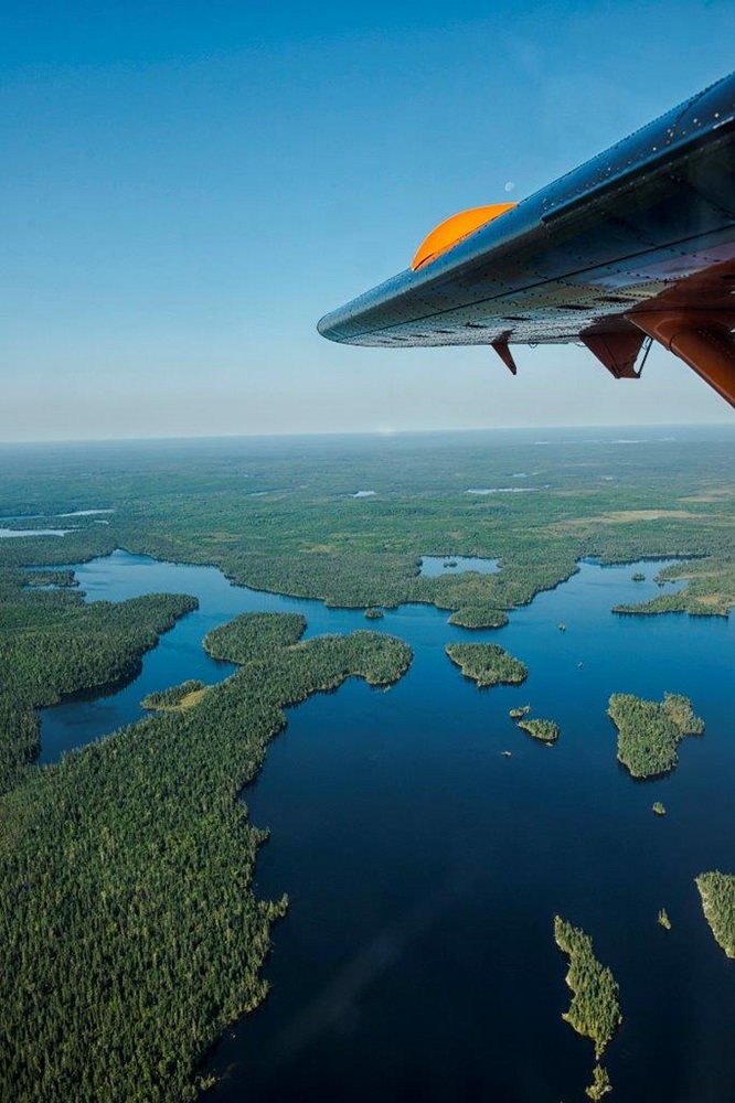
Flying into Wabakimi is a very exciting option for your trip and can grant you access to more remote areas of the park.
Outfitters and local air services are available to fly you into the park and/or pick you up at the end of your trip. They can also often assist with vehicle parking and ground travel.
For information and service providers related to planning flights into the park the contact one of the area’s tourism organizations:
2. Plan your route wisely
Please do advanced research on the route you have chosen to travel.
Some areas of Wabakimi are easier to travel than others, and some areas are used more frequently than others. Always take into consideration that water levels, rapids, and portage conditions can vary depending on seasonal weather conditions.
This blog describes the variety of backcountry travel to experience within the park.
Maps
Prepare for your upcoming backcountry trip in Wabakimi’s waterways by mapping your paddle and portages ahead of time.
The Wabakimi Park Planning Map is available for purchase, providing details on general route information.
The Friends of Wabakimi also offers a series of canoe route maps in the Wabakimi Area.
In addition, ensure you carry detailed 1:50,000 scale topographic maps for accurate navigation.
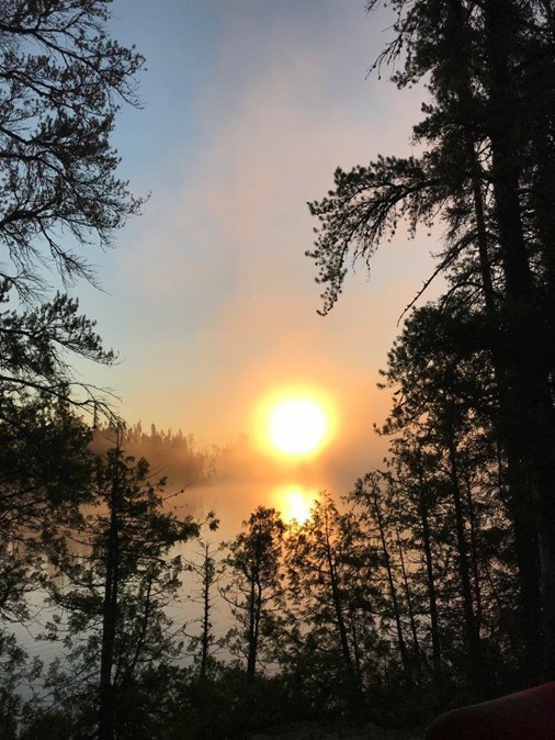
3. Prepare for seasonal weather
There are a few things to look forward to during your paddling trip and also some things to keep in mind.
The summers in Wabakimi Provincial Park are hot and dry with an average July temperature of 18.4°C (65.1°F).
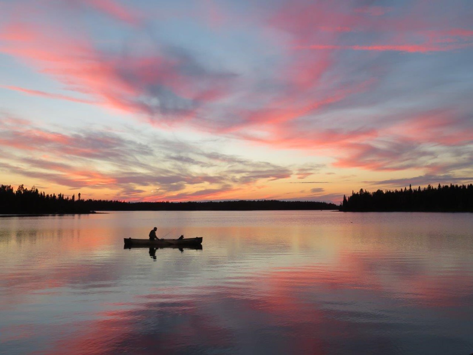
The prime canoeing season typically begins in early June and lasts until mid-September.
After mid-September there can be unexpected storms, adverse weather conditions, frost and potentially snow.
Always be prepared when you are going into the backcountry for any length of time.
Carry necessary safety equipment and adequate food, as well as clothing. Always know your backcountry limits.
4. Keep nearby services in mind
Nearby communities
Armstrong — 3 hours north of Thunder Bay up Highway 527. The most popular town to use when accessing Wabakimi Provincial Park. Armstrong offers basic facilities and services with road, train, and aircraft access opportunities to the park.
Savant Lake — 4.5 hours from Thunder Bay up Highway 599. Basic facilities and services with train and canoe-in park access are available.
First Nations — Whitesand, Namaygoosisagaun, Ojibway Nation of Saugeen, Mishkeegogamang, and Eabametoong First Nation all surround Wabakimi Provincial Park. Please be reminded that we are on traditional lands and to be respectful to individuals with treaty rights that you may encounter within the park.
Outfitters
Although Wabakimi is a wilderness backcountry park, some fly-in tourist outfitters can offer barrier-free access to this wilderness experience.
Boat rentals are also available in some locations through local tourist outfitters in the area.
5. Registration and park regulations
An interior camping permit is required for camping and canoeing in Wabakimi Provincial Park.
Permits can be purchased online (2 weeks in advance) on the reservation site, from the park office in Thunder Bay, or from local Armstrong outfitters.
Your permit must be carried with you at all times should a park warden or conservation officer ask to see it.
While on your own canoe trip or being guided by an outfitter, consider how your actions can affect the natural surroundings and natural resources of Wabakimi.
A number of provincial park regulations are enforceable within Wabakimi. These are in place to fulfill the protection mandate of the provincial park system and to ensure every visitor has a safe and enjoyable experience.
Start planning your backcountry paddling trip and experience what Wabakimi has to offer!
Wabakimi Provincial Park is located north of Armstrong, Ontario, three hours from Thunder Bay.