Today’s post comes from Jordan Welch and Bianca Goncz, Discovery staff at Lake Superior Provincial Park.
Are you looking for a challenging, multi-day hike with spectacular views?
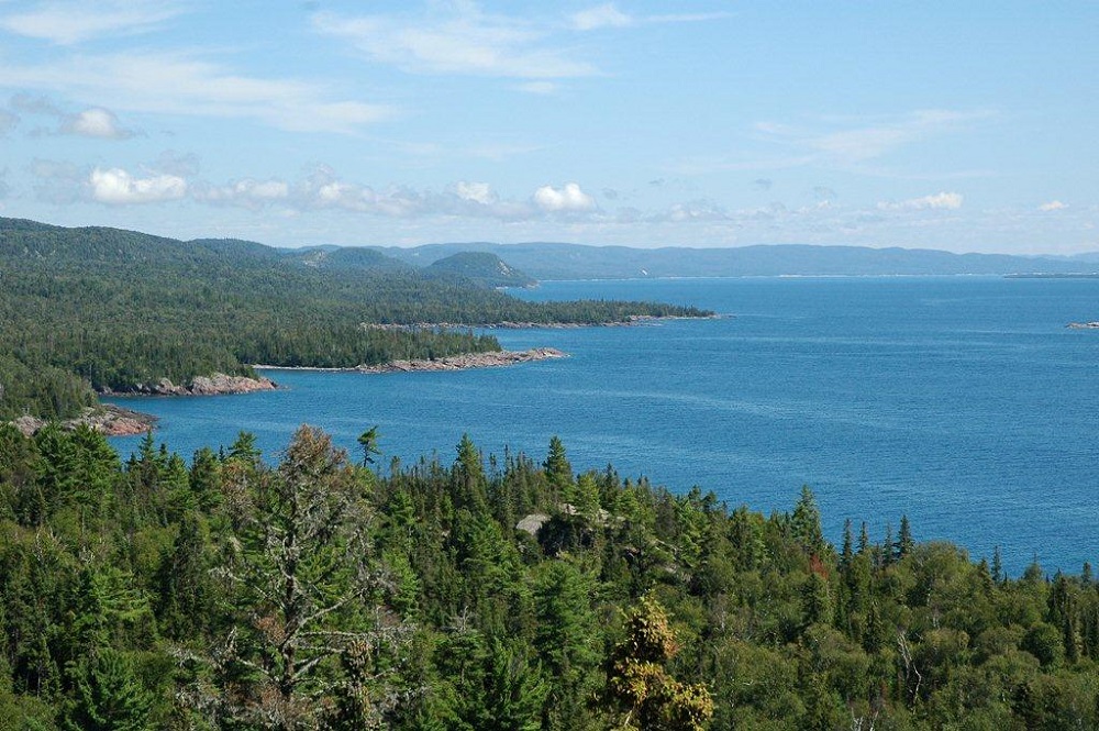
The Coastal Trail has it all!
Hike to rocky bluffs, traverse lush forests, and experience the power of Lake Superior.
This linear trail traces 65 km of Lake Superior’s rugged northeastern shore, offering an unparalleled chance to experience the wilderness and beauty amidst the largest of the Great Lakes.
With multiple access points, the route options are endless.
Challenge yourself over several days to complete the trail from end-to-end or pick a smaller section to dip your toe in!
Here’s how:
Your step-by-step guide to planning a Coastal Trail trip
1. Gauge your experience level — have you backcountry hiked and camped before?
It’s important to be mindful of your limits and skill level to plan a realistic trip.

While the entire Coastal Trail should only be undertaken by experienced hikers, there are lots of options for newer backcountry hikers with shorter distances and/or less rugged sections. See the Coastal Trail breakdown below for help.
Beginner * – has completed some moderately challenging day hikes and may have completed a single overnight backcountry trip.
Intermediate * * – has completed a few 1-2 night trips, and many moderate to advanced day hikes.
Advanced * * * – has done overnight trips of 4+ days on rugged terrain, used to elevation changes, and well-versed in demanding day hikes.
2. Call park staff
We are happy to answer any of your questions.
Reach out to us at the Visitor Centre at Agawa Bay (705-882-2026) from mid-May to mid-October, or the Park Office at Red Rock Lake (705-856-2284) year-round.
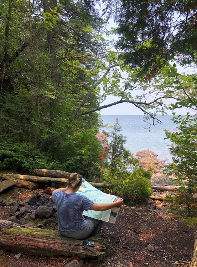
3. Buy a map
A map is your best resource for trip planning and navigating.
Purchase one at the park Visitor Centre or Red Rock office when you arrive.
4. Build your trip
Decide where you’d like to start hiking from, and where you plan to stop each day.
If you’re new to overnight hiking, it’s best to choose zones that are closer together to make your journey less demanding.
5. Make a reservation
As of 2021, Lake Superior’s backcountry now requires a reservation for camping. Reservations are also available for day use.
Reservations can be made online here, or by calling 1-888-668-7275.
6. Book a shuttle (if needed)
There are several local shuttle options from third party operators. Check with park staff for more information.
7. Familiarize yourself with park rules
Special rules apply in Ontario Parks, including a can and bottle ban in the backcountry.
Please consult our website to stay informed.
8. Make a packing list
Backcountry camping is a fine balance between packing light and making sure you have all the essentials.
This blog post can help you get started.
9. Stop in at the Visitor Centre at Agawa Bay
We can print your permits, advise you of current trail conditions, and tell you everything else you should know before you set out.
10. Hike the coast
Now for the fun part!
The Coastal Trail is as demanding as it is rewarding; make sure to stop in on your way out to tell us about your adventure!
To help you plan your Coastal Trail hike, we’ve broken down the different sections to brief you on the terrain.
All distances are one-way and approximate. Difficulty levels are noted with the following symbols: * beginner, * * intermediate, and * * * advanced.
Gargantua North — fantastic forest (15.7 km)
Gargantua Road is the northernmost access point of the Coastal Trail. If you plan to hike this section, keep in mind that you’ll have to double back!
Hiking north from here follows an old logging road through one of the trail’s more inland and forested sections.
The trek is fairly flat with a gradual uphill from Gargantua Bay, followed by a short, steep descent to the bridge at Gargantua River.
The trail then forks around Cape Gargantua, with the left fork following the river out to Warp Bay. *
Continue past Warp Bay through young trees, beard lichen, and tiny lakes to explore small rocky inlets and a lookout of Chair Island.
The right fork takes you through a stunning forest, then climbs over exposed rocky sections to views of islands in a small harbour.
Climb back down to reach Chalfant Cove; the northernmost point of the Coastal Trail (good job!). * *
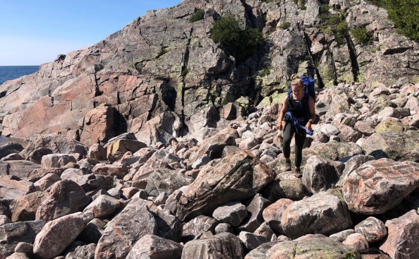
Gargantua to Orphan Lake — rocks, rocks, rocks (18.5 km)
Travelling south of Gargantua Bay is decidedly different from going north.
A steep forested ascent takes you up to one of the rockiest and technically demanding sections of the trail (and we mean rocky).
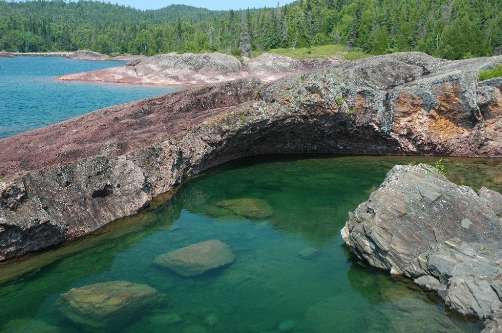
Prepare for stunning views, but also some of the most challenging days on the Coastal Trail, especially if conditions are wet! Climb down and over rocks to Rhyolite Cove, a small shallow inlet of striking red rock.
From here, the difficult (but strikingly beautiful) trekking continues to Beatty Cove and Orphan Lake with tricky rugged sections veering in and out of the forest.
The end of this segment marks the transition from drastic elevation change along the northern portion to the weathered bedrock of the middle section. * * *
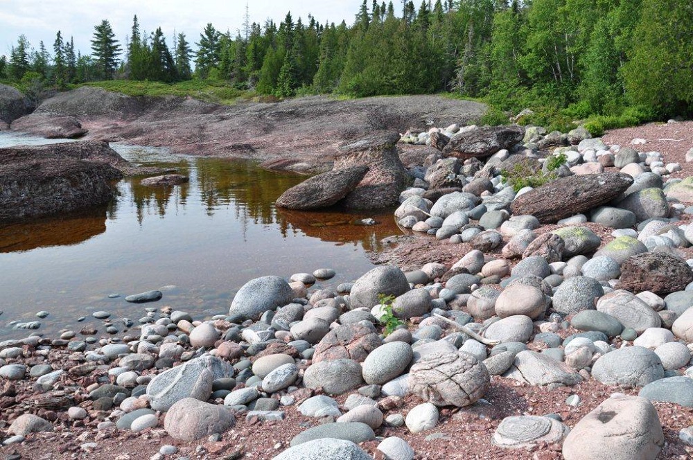
Orphan Lake to Katherine Cove — don’t take it for granite! (14 km)
Orphan Lake is a good midpoint access to the Coastal.
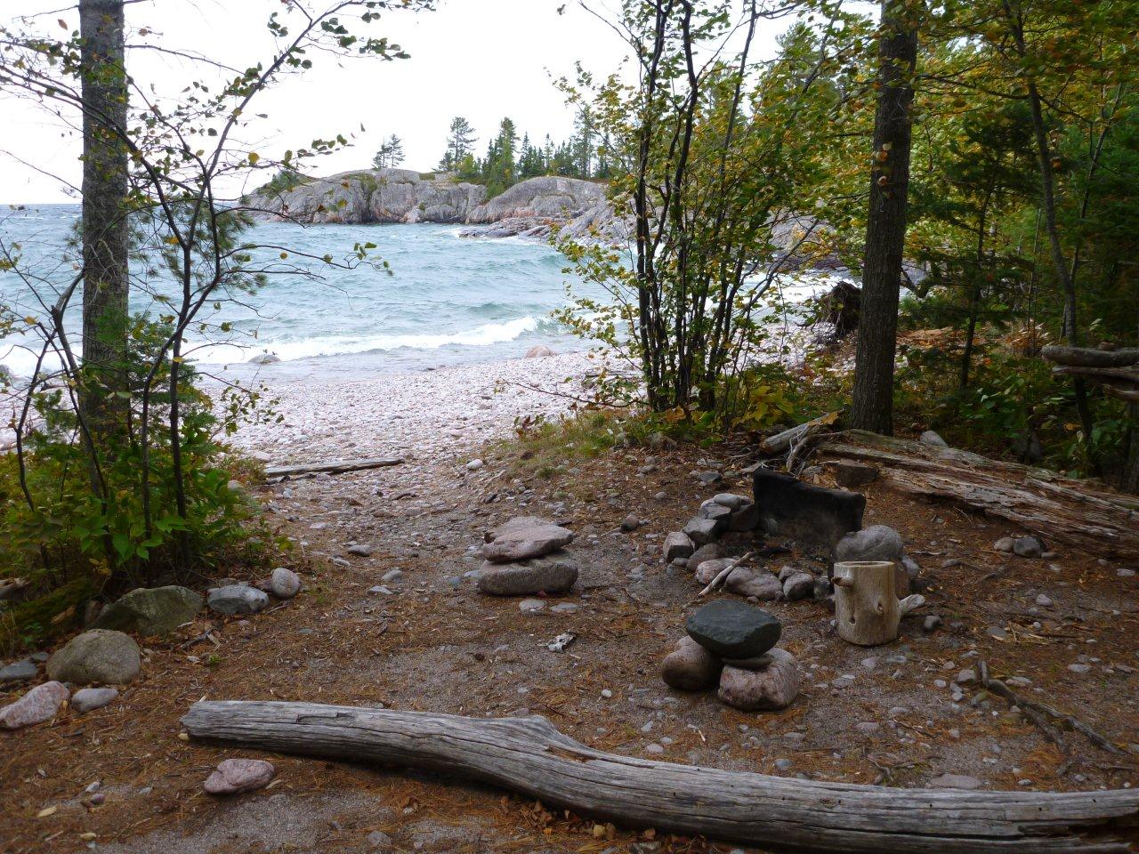
Hike 4 km in from the Orphan Lake Trail to reach the mouth of the Baldhead River. Here there is a pebble beach with golf ball to tennis ball sized rocks.
These rocks can be unruly — so take this section nice and slow, especially when wearing a pack!
At the end of Baldhead Beach, you will reach the dreaded Baldhead Hill. This is the final hill before Coldwater River, and it’s a doozy!
We recommend a very convincing pep-talk before embarking on this climb. * * *
After Baldhead Hill, be sure to give yourself a pat on the back before you begin the walk across the Coldwater River beach.
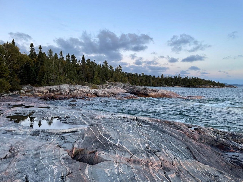
Between Coldwater River and Katherine Cove you will experience colourful coastal geology, along with small inlets and vernal rock pools.
While this section can be especially slick after rain, it is a welcome “break” after the Gargantua to Orphan Lake section. * *
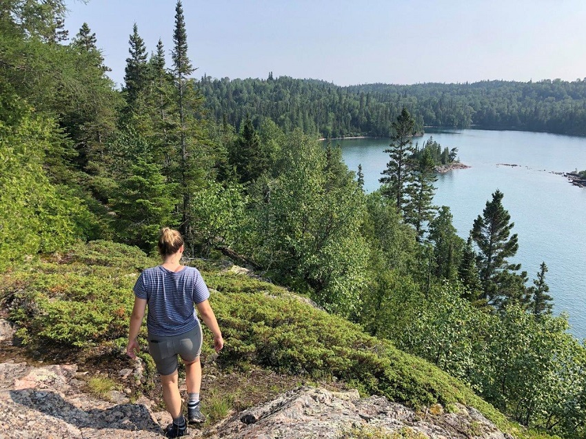
Katherine Cove to Sinclair Cove — forest, coast, repeat (17 km)
From Katherine Cove, the rough topography continues with lots of boulder hopping at lake level.
Expect frequent traverses across rocky coves, alternating with forested sections and sand or cobble beaches.
The winding nature of the shoreline can taunt you, as once again you may find yourself covering less ground in comparison to more linear hikes you’ve done before.
Don’t forget to enjoy the scenery as you weave in and out, though!
Several close islands are visible as you head past Barrett River * * and over rocky outcrops to Sinclair Cove. * * *
Bonus point to those who can spot the large glacial erratic along the way!
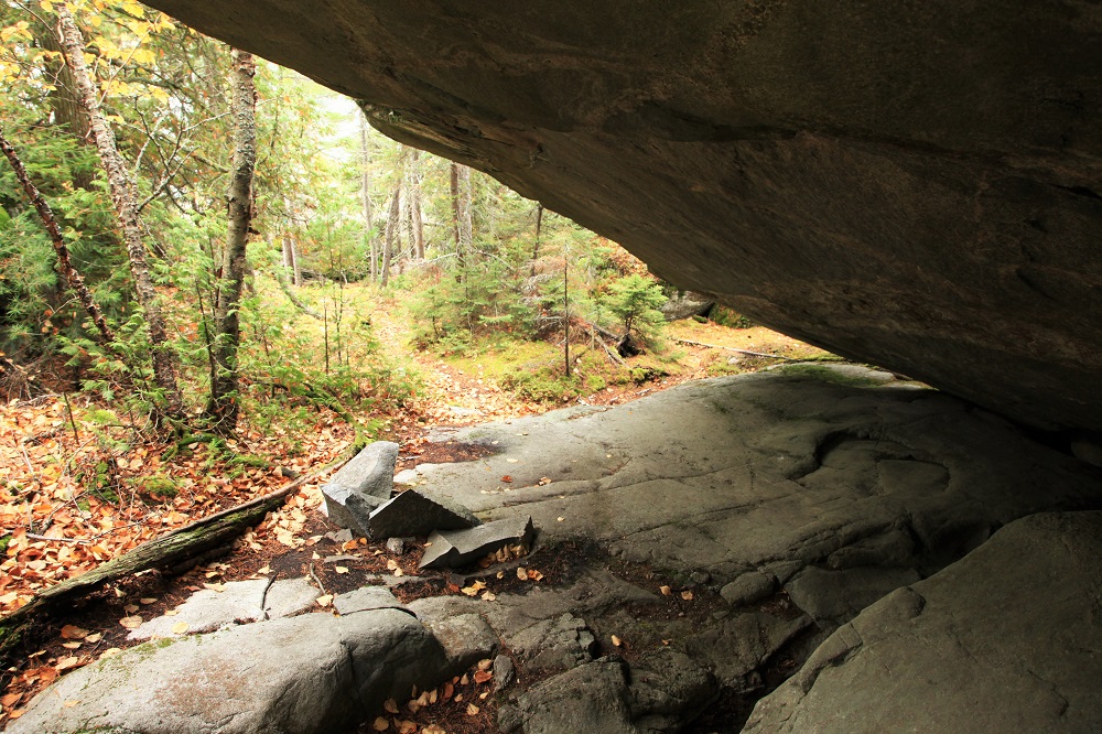
Sinclair Cove to Agawa Bay — the home stretch (11 km)
Sinclair Cove marks the beginning of the end.
Although it appears close to Agawa Bay on the map, this landmark, accessed from Sinclair Road, is deceiving. This is one of the harder sections of the trail, and your pace will slow significantly.
From Sinclair to the north end of Agawa Bay, you will cross steep and slippery terrain, but also be rewarded with spectacular vistas over the lake.
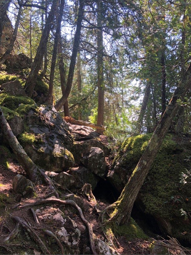
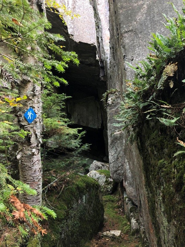
While squeezing between boulders, climbing granite hills, and navigating giant caves, you will get up close and personal once again with the dramatic geology of the park. * * *
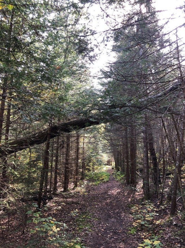
When you finally make it to the north end of the Agawa Bay beach, it is smooth sailing… or tranquil trekking.
Take in the tall pine forest as you hike the last hour to the Visitor Centre — you’ll know you’re close when you reach the flagstone path! *
Don’t forget!
Now that you’re armed with some knowledge about the Coastal Trail, here are some tips you should also keep in mind:
Mind the weather
Your hiking pace will be dictated by the wind, waves, and precipitation of Lake Superior.
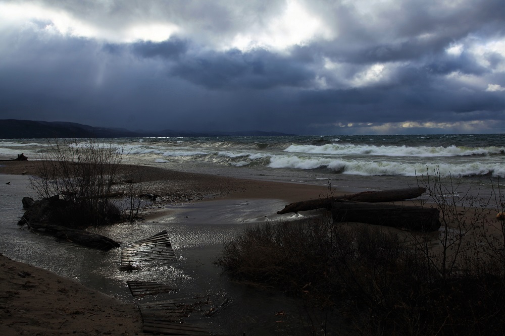
Ensure you triple check the forecast and come prepared for anything.
If you run into inclement weather while you’re hiking, hunker down and wait it out. Safety first, always!
Leave no trace
Respect wildlife and the land you’re on. Don’t feed anything or leave anything behind.
Allow the people after you to enjoy these spaces for years to come.
With steep inclines and rugged coastal geology, careful foot placement is key on this grueling yet gratifying trail.