Today’s post comes from Kristiana Wilson, Assistant Park Superintendent at Woodland Caribou Provincial Park.
2021 was quite the fire season in Ontario.
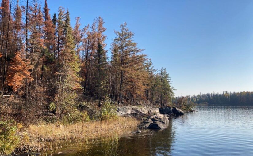
Last year alone, approximately 55% of Woodland Caribou Provincial Park burned due to natural forest fires.
The park is no stranger to forest fires — fire is key for regeneration in the boreal forest.
Still, when most people think of picturesque park landscapes, they typically don’t think of park areas that have been burned.
We’re here to change any preconceived ideas you have about travelling through large burns and share some tips to make your next post forest fire park paddling trip a little easier!
Watching for wildlife
Although it may be tricky travelling through a recent burn, it is an experience like no other that provides you with a little extra challenge on your adventure.
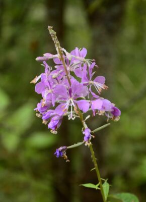
You’ll see growth of alders and plants such as Bluebead Lily and the purple colour of Fireweed as the forest regenerates.
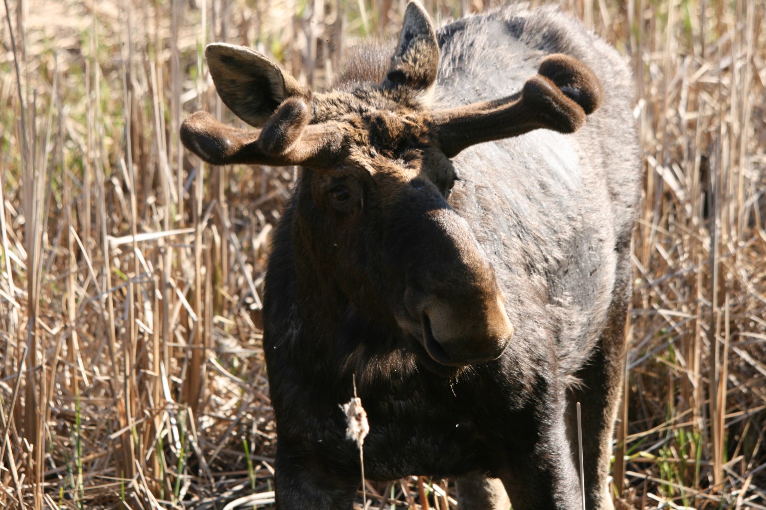
You’ll be greeted with ample opportunities to view wildlife, including species that visit immediately following fire events, like Black Backed and Three-Toed Woodpeckers.
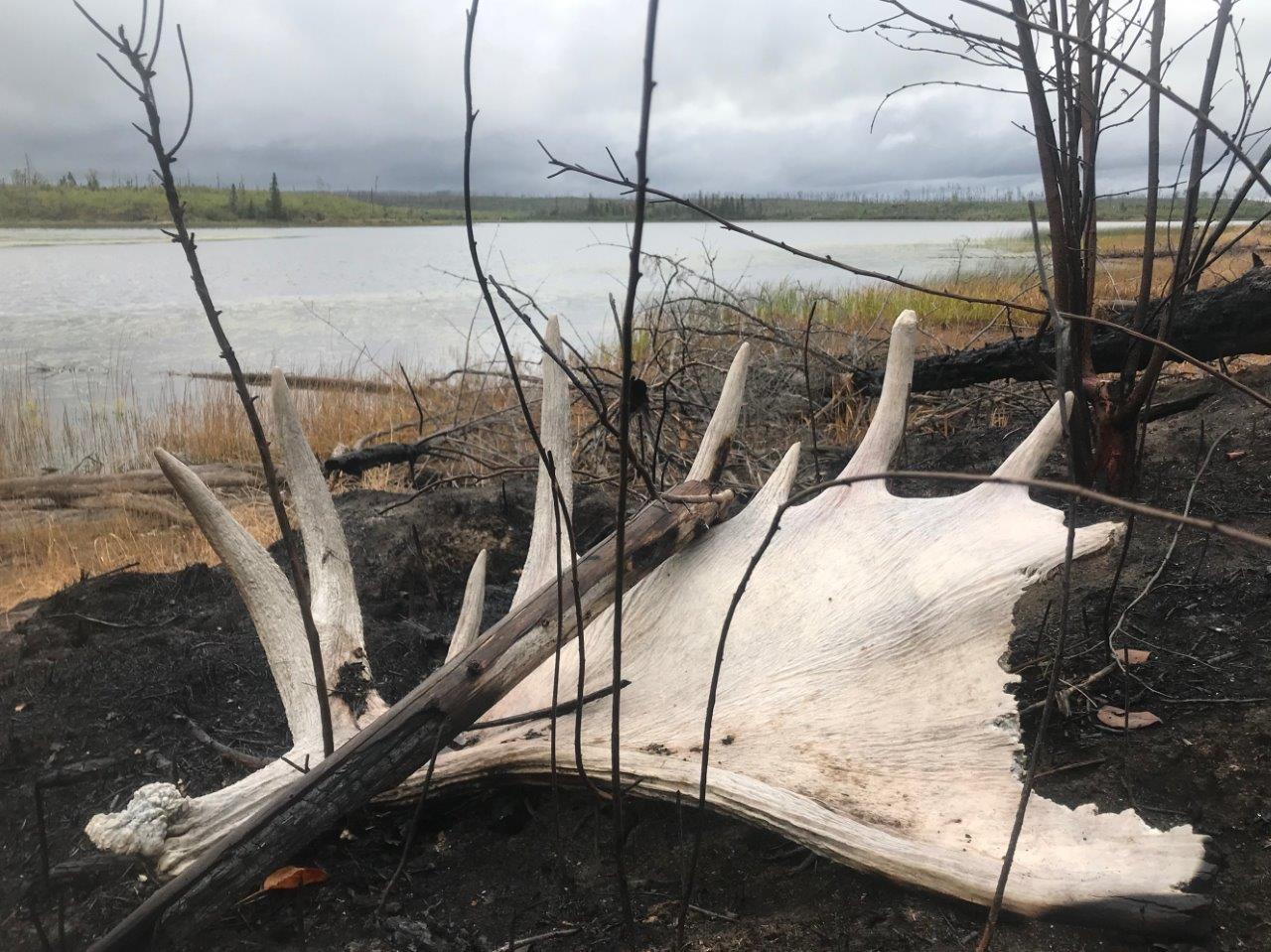
Several years post-burn, you may even be lucky enough to see Moose munching on new shrubs!
Seeing green
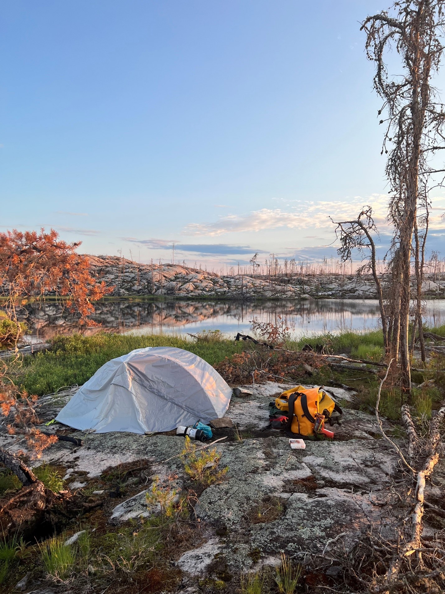
One thing to keep in mind is that fires don’t always burn evenly across the landscape. You may be able to travel through a recent burn that still has a lot of green patches of forest.
You might also find a portage trail that is burnt only on one side or a completely green campsite you didn’t expect!
This all depends on the intensity of the fire.
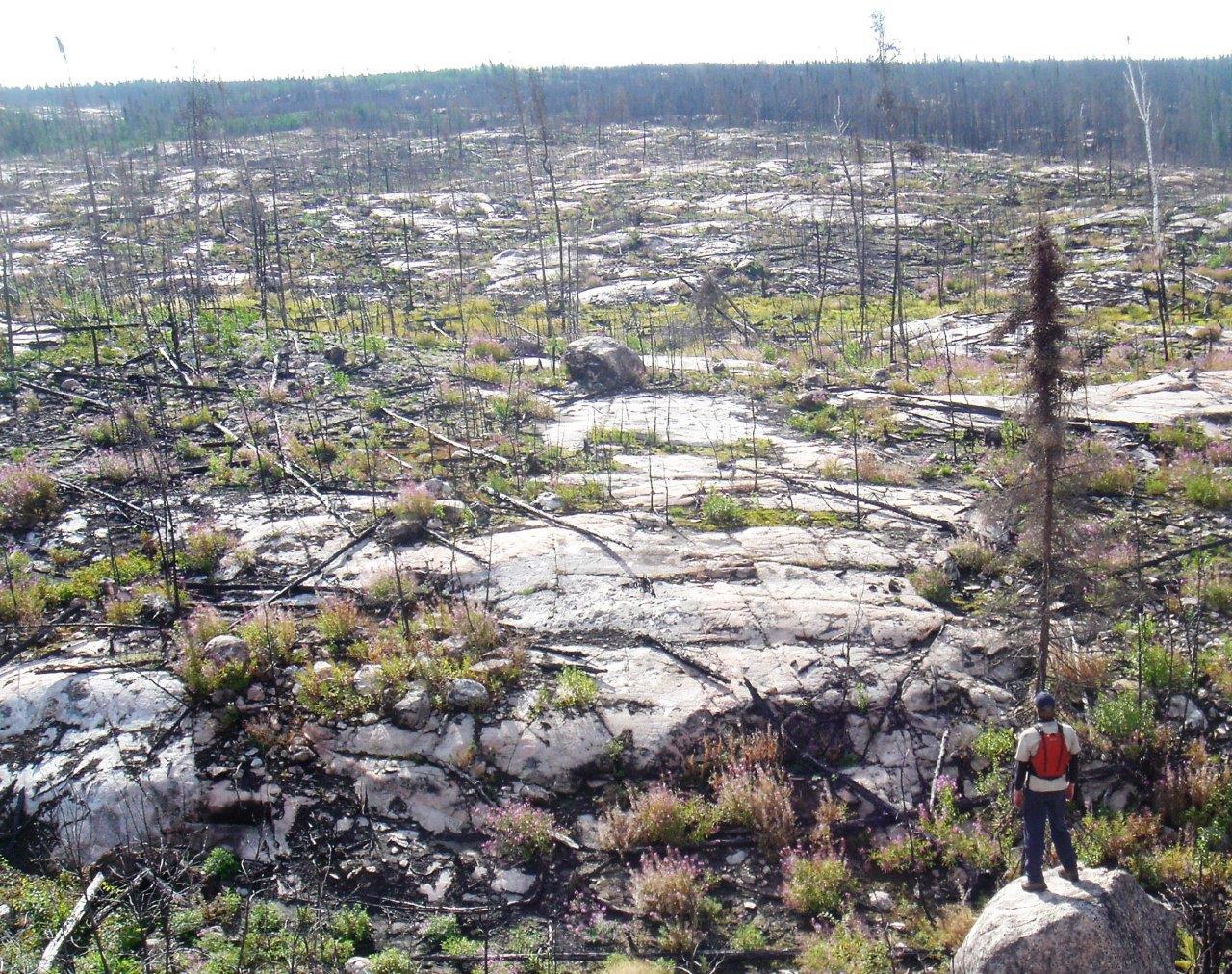
Surface fires burn the plants beneath the forest canopy, but typically do not kill mature trees. You’ll be able to camp in these mature forests soon after a fire.
Although the first year or two following a burn can make for tricky navigation, (especially if crews haven’t visited the trails yet) there are things you can do to ease your travels.
Get familiar with your route
A park’s canoe route map is your first step to nailing down your chosen route.
From there, a topographic map can help you pinpoint the details of your route, including where portages start and end.
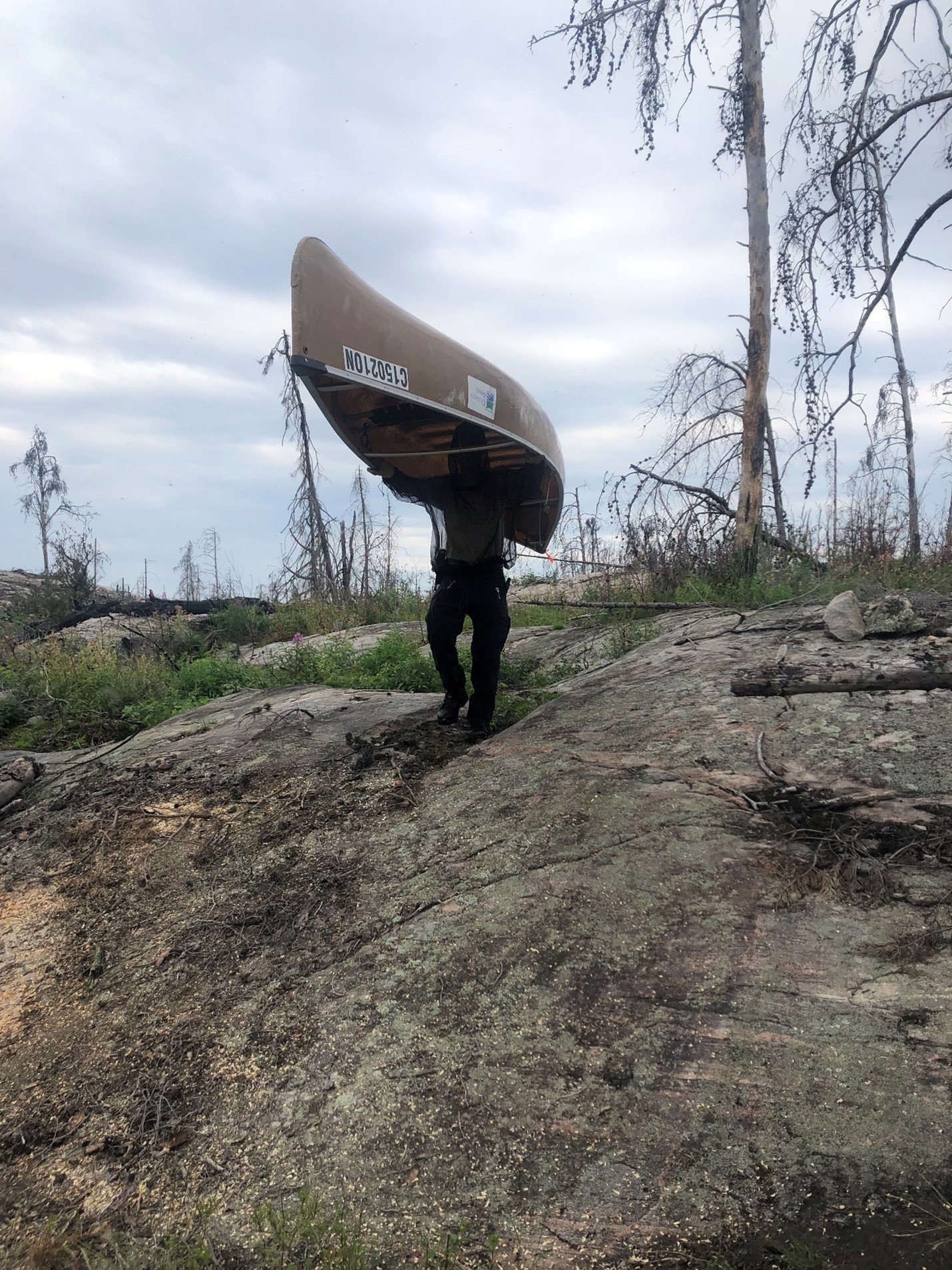
Keep in mind that portages usually follow the easiest route.
Look for straight pathways between trees. Lining up these straight-aways with natural openings in the forest may give you hints that a path was once there.
A GPS is also a handy tool for tracking down those harder to find portages!
Look down!
Once you’re on a trail, there will be subtle hints along the way that will help guide you.
When the ground gets compacted from traffic, the portage path may not actually burn.
This isn’t always the case, but there are other clues you can keep an eye out for as well.

If much of the forest ground litter has burned away, traces of the last park portage crew’s work in the area may still be found to help you out.
When a tree has fallen over the trail in the past and has been cleared away, you’ll see a cut stump or end of a log on either side of the portage. Although the wood burns, often the crisp edge of a chainsaw cut is still visible.
Look to the ground for signs of cutting and walk between the two cut edges — you’ve found a portage!
Rock cairns and flagging tape
Although our portage routes are normally marked with tree blazes, park staff sometimes need to use rock cairns or flagging tape to temporarily identify portage routes after a burn.
This is necessary where burned trees will likely fall over with time leaving much more exposed bedrock to navigate.
Keep an eye out for these trail markers. They will help guide you when the path gets tricky or unclear.
Look up!
Whether you’re on the trail or on your campsite, always be aware of your surroundings.
Avoid camping under burned trees and branches that may fall on you. Even a little burn in the root system can compromise a tree, making it unsafe.
Be aware when travelling on portages, especially on windy days.
Always choose your campsites and travel routes wisely.
A more serene experience
Often after a park has experienced a forest fire, visitors may be reluctant to return right away.
This means that you may well encounter fewer people during your travels in the park.
Planning a trip post-fire will enable you to not only witness the wonders of nature regenerating itself, but also provides an added amount of solitude during your trip.
Want to learn more?
Visit our Woodland Caribou Trip Planner Blog for current park conditions.
Contact park staff at 807-727-1329 or Woodland.Caribou.mnr@ontario.ca for pre-trip to assistance with your post-forest fire trip planning.
A forest fire burn can be a beautiful thing!
Whether you’re planning a post-forest fire trip to Woodland Caribou or another wilderness park, we hope these tricks will help you navigate your way through any recently burned areas of the park.
There is an unspoken beauty to travelling through a park’s recent burn — we hope you visit soon!
Woodland Caribou Provincial Park’s closest access point (Johnson Lake) is located approximately 34 km northwest of Red Lake, Ontario.