This post was written by Northwestern Ontario Parks Planning Intern Kestrel Wraggett.
We know that Ontario Parks protect some of the most unique and precious natural systems in the province, but did you know we help protect a nationally recognized network of significant waterways called the Canadian Heritage Rivers System (CHRS)?
One river, two provinces
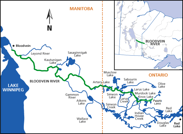
The Bloodvein River flows across two provinces and through two provincial parks: Woodland Caribou Provincial Park in Ontario and Atikaki Provincial Park in Manitboba.
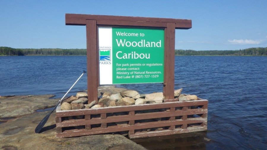
Woodland Caribou Provincial Park is located west of Red Lake in northwestern Ontario. This 470,620 ha wilderness-class park is part of a larger Signature Site system comprised of Woodland Caribou, Eagle-Snowshoe Conservation Reserve and Pipestone Bay-McIntosh Enhanced Management Area.
The system as a whole includes critical caribou habitat, significant earth and life science features, important cultural sites and backcountry recreation opportunities.
Atikaki Provincial Park in Manitoba, is located adjacent to the Woodland Caribou Provincial Park and is a wilderness class park of 398,130 ha. This park also protects critical caribou habitat and significant ecological features, and boasts one of Manitoba’s finest whitewater opportunities.
Together, through coordinated efforts by both provincial governments and via a Manitoba Ontario Interprovincial Wilderness Area Agreement, these parks protect the CHRS-designated Bloodvein River.
The Bloodvein River itself is a total length of 306 km through both provinces, 106 km in Ontario and 200 km in Manitoba. The Manitoba portion was designated in 1987, and the Ontario side in 1998.
The ecological story
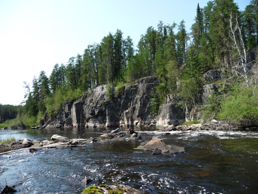
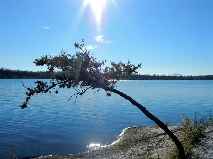
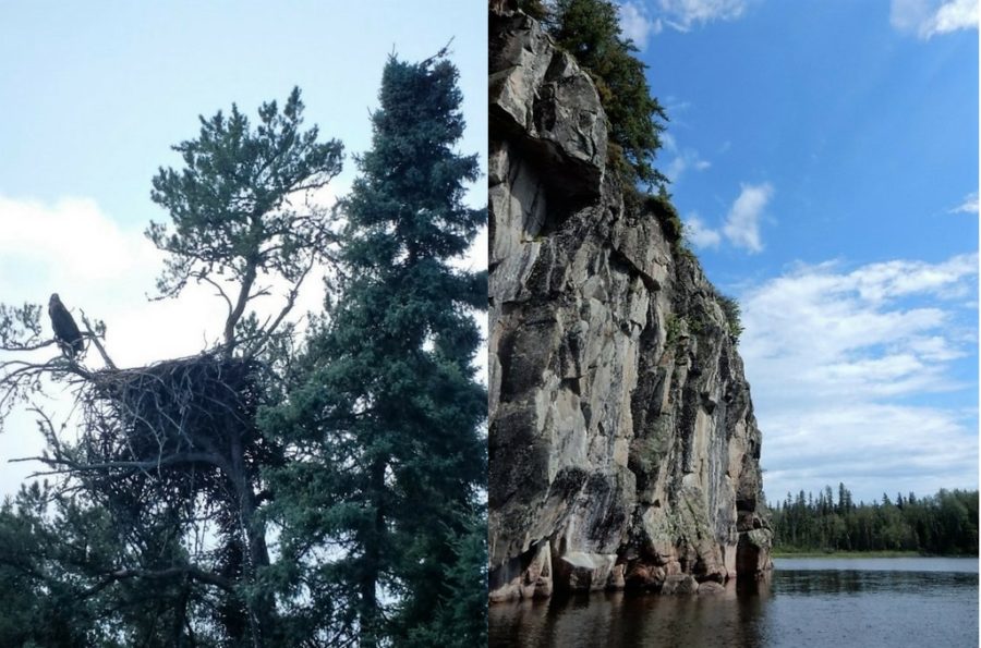
The Bloodvein River flows through the Precambrian Shield and through undisturbed prairie-boreal and central boreal upland landscapes.
The Bloodvein River system provides a home for many species, including Wolverine, American White Pelican, Double-crested Cormorant, Bald Eagle, Osprey, Great Gray Owl, Trumpeter Swan, and Woodland Caribou.
A recreationist’s dream
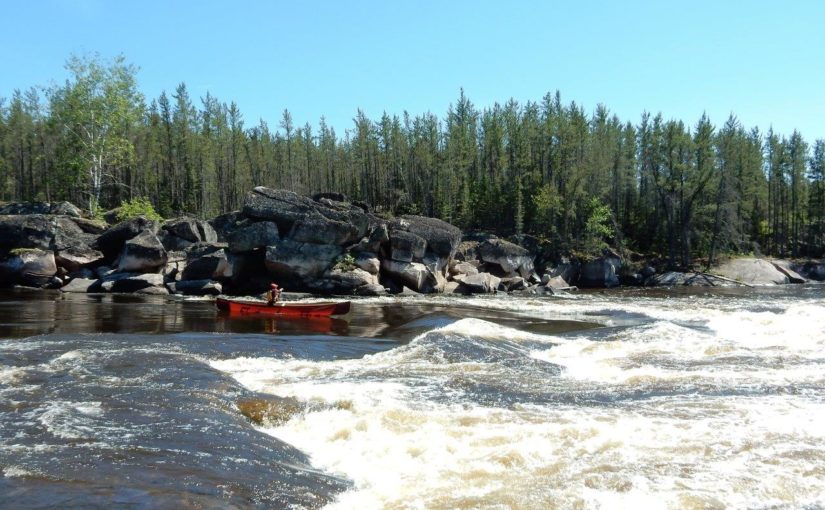
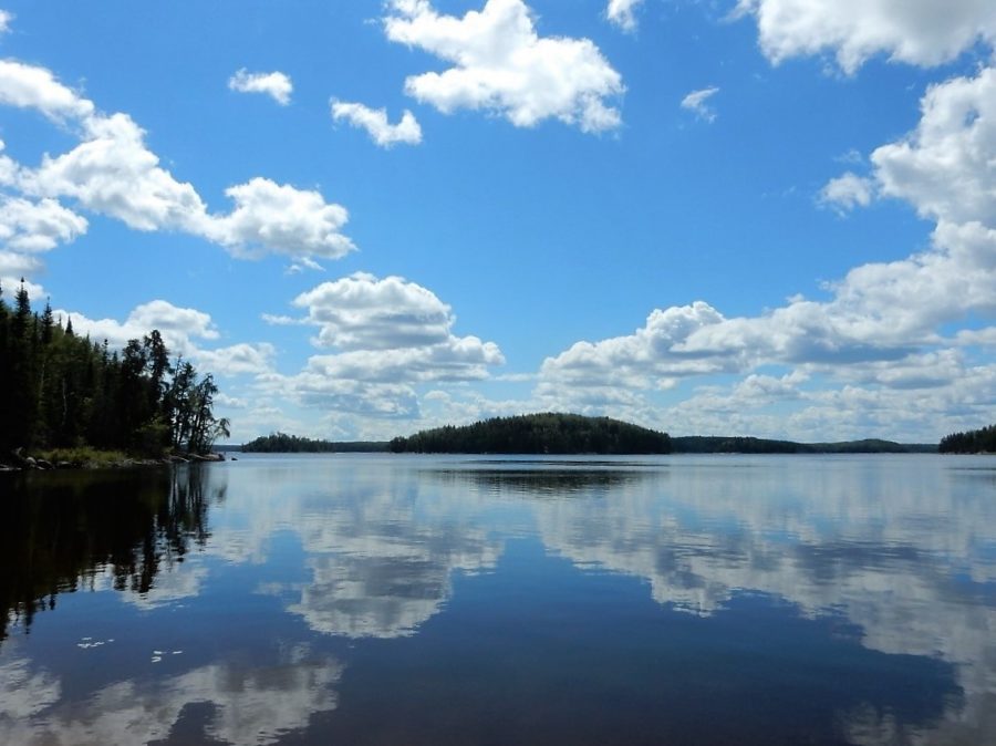
The Bloodvein is the largest river running through Woodland Caribou Provincial Park, making it a destination for backcountry canoeists.
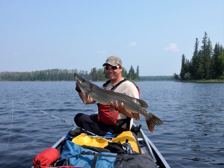
The river is known for its whitewater canoeing and camping opportunities. The Bloodvein River provides habitat for healthy Walleye, Northern Pike and Lake Trout populations and offers high quality sport-fishing adventures.
Some tips before embarking on your journey
Access to Bloodvein River takes some advanced planning on the part of the visitors. There are a few waterway access zones leading into the river starting in Red Lake, then paddling north with a number of maintained portages.
The most direct access to the headwaters of the Bloodvein is via Lund Lake. A forest access road leads visitors to the Pipestone Bay/McIntosh Enhanced Management Area where visitors may park their vehicle and portage directly into Lund Lake. At the other end of the river, there is a road that leads to the Bloodvein First Nation in Manitoba.
Another access option is to hire a floatplane service and fly into one of Woodland Caribou Provincial Park’s access zones on the system. The limited access adds to the remote wilderness experience of the river.
The Bloodvein River has been traveled by the Anishinaabek for thousands of years
The surrounding Indigenous communities have strong historical and cultural ties to the river and the area as a whole. There are many significant archeological and cultural features along the waterway including a number of pictograph sites.
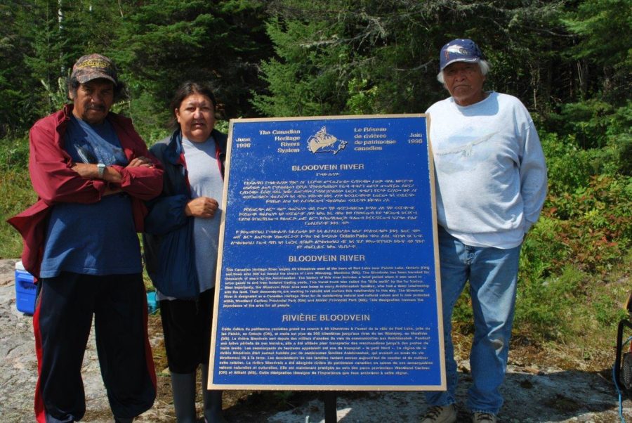
Ontario Parks works closely with the surrounding Indigenous communities on a number of different projects. The language on the plaque (shown in both Ojibway and English) was developed by the local Anishinaabek, who also chose the location on the river and installed it with parks staff. There was a big ceremony in Red Lake for the unveiling.
A place to marvel at the beauty of nature
If you are a backcountry paddler, angler, or wildlife photographer, the Bloodvein River is a bucket list destination. With a little bit of advanced planning and a longing for adventure, you could be paddling and exploring through some of the most undisturbed wilderness in the country. The Bloodvein River truly lives up to its designation as a Canadian Heritage River.
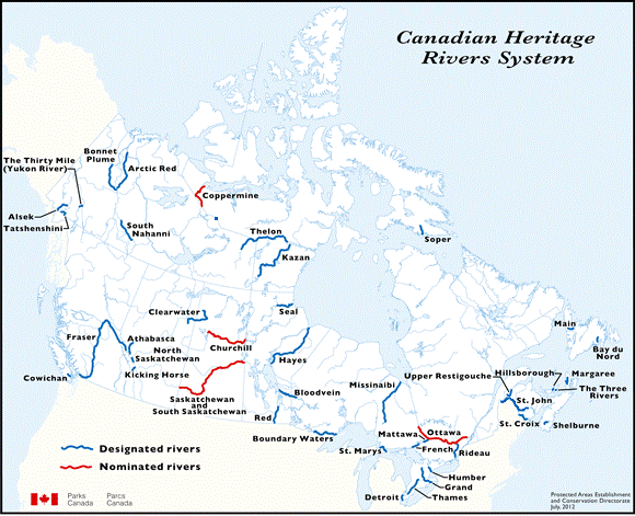
The CHRS was established by the federal government with support from provincial and municipal governments and in partnership with community groups to ensure the long-term conservation of Ontario’s most precious resource — fresh water. You can learn more about the CHRS at http://chrs.ca/about/
Also read about the Boundary Waters/Voyageur Waterway Canadian Heritage River.