
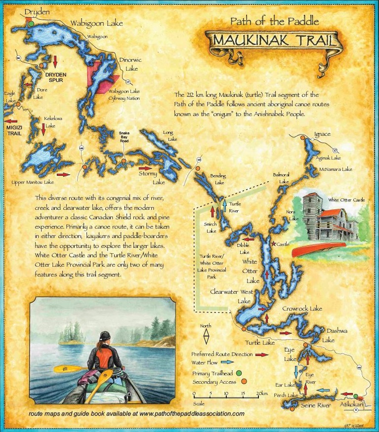
Today’s post comes from Lise Sorensen, Quetico’s Atikokan Entry Station Gate Attendant and off-season Trails Officer with the Path of the Paddle. If you’re planning to paddle the Maukinak Trail, this info will be indispensable.
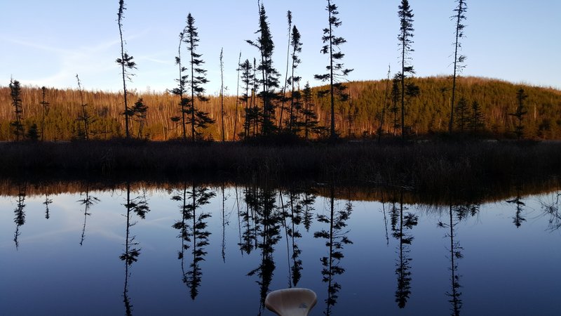
Follow the path. It will lead you through boreal rivers and crystal-clear lakes, and past silent, watchful cliffs. Your guides will be eagles and your destination endless.
An integral segment of The Great Trail (Trans Canada Trail), the Path of the Paddle is a ribbon of water that stretches from Thunder Bay to the Manitoba border.
The Maukinak segment of the Path of the Paddle transects vast tracts of uninhabited crown land and connects the small communities of Atikokan and Dryden.
Best traveled with the prevailing west wind, the route is easily accessible from the Dore Lake Road, the Snake Bay Road, and Highways 502 and 622.
South of Dryden, the Path can be accessed from Highway 502 or the Dore Lake Road. Dore Lake offers excellent Walleye fishing.
Utterly remote
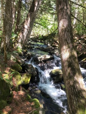
Traveling south through Ingall and Kekekwa Lakes, all of the portages follow clear, flowing streams. You will never be far from the sound of running water, especially near Ingall Falls and Kekekwa Falls.
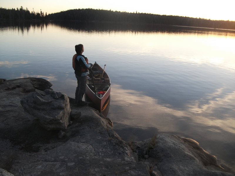
One of the portages on Kekekwa Creek (the most easterly) takes you through an unusual micro-environment, where a pocket of elm trees has survived under a sheltering cliff on the north side. Heading south from this point, the creek meanders through a raised bog, where pitcher plants grow at eye-level. Aside from its road access, Kekekwa Lake is utterly remote.
South of Kekekwa, portages connecting Navimar and two other small lakes, pass through shady, mature groves of cedar, following clear brooks that sometimes collapse into small waterfalls.
A lake notable for its clarity
Navimar Lake is notable for its clarity. After years of disuse, these portages still retain traces of human activity, like the bones of an old cedar-strip canoe south of Navimar.

A brand new 1 km portage skirts the end of a ridge north of Harper Lake. Take a break at the halfway point and climb a gentle slope to a wide, open outcrop that looks out across Harper to the islands of Upper Manitou Lake.
A gold mine (literally)
Upper Manitou has been inaccessible by road for years. Around the turn of the century, it was home to “Gold Rock,” a significant gold mining operation. You can still see the remnants of a stamp mill and scattered pieces of antiquated machinery.
The lake is large and islands on the east side offer shelter, but check the wind forecast and plan to travel open stretches during morning and evening hours.
A two-day paddle commences
At Rattlesnake Creek, just east of Upper Manitou Lake, the canoe route is intersected by Highway 502, offering easy access 65 km south of Dryden.
From Rattlesnake Lake, a two-day paddle commences through small, sheltered trout lakes connected by clear, flowing streams and (mostly) short portages of 250 m or less. This segment is best traveled west-east with the prevailing wind.
Clear streams and ample shade
At Katisha Lake, the route crosses the Snake Bay Road. It is suitable for smaller vehicles as long as they can handle gravel and a few significant potholes. Highway 17 is just 30 km to the north of the Katisha Lake landing.
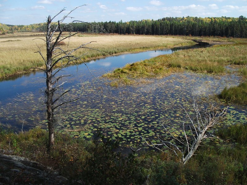
The portages between Katisha Creek and Stormy Lake follow clear streams and offer ample shade. Some waterways here feature expansive fields of water lilies.
This area is rich in wildlife. You may encounter nesting Trumpeter Swans, or catch a Moose or Black Bear swimming across a channel. Stormy Lake is a large, clear trout lake, fringed with tall white pine and overshadowed by spectacular cliffs along the north shore of Snake Bay.
Trek with a staircase of small waterfalls
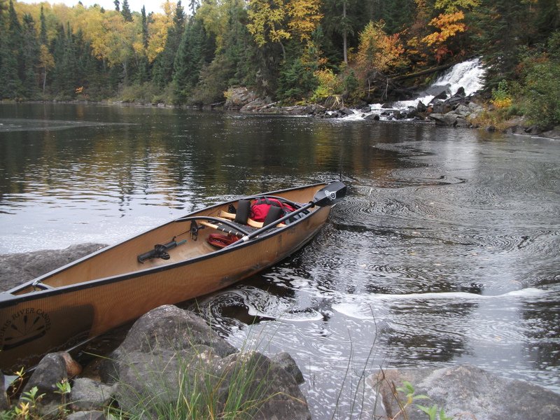
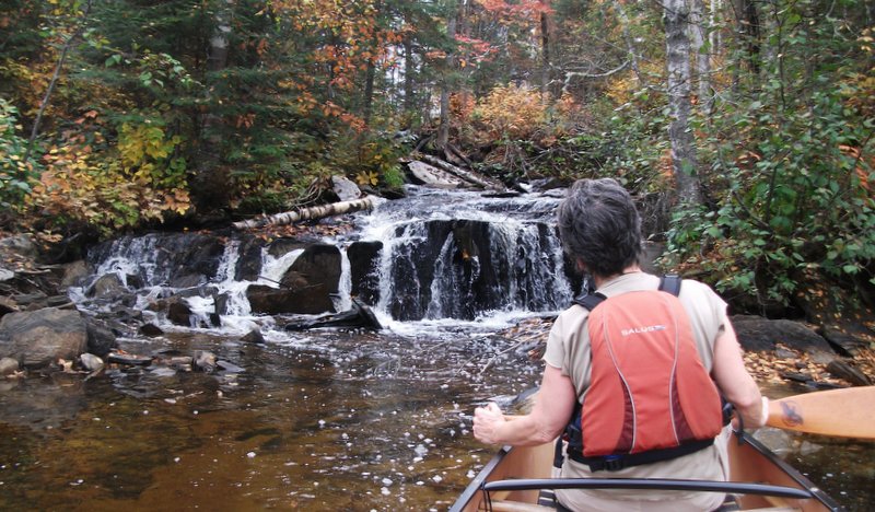
Between Stormy Lake and Long Lake, the portage runs along a staircase of small waterfalls. The portage to Three Mile Lake passes through old-growth cedar forest with mosses and liverworts evocative of the Canadian west coast.

Highway 622 intersects the Maukinak Trail 20 km south of Highway 17 between Bending Lake and Three Mile Lake, and offers a secondary access point via the Turtle River.
Run some easy rapids
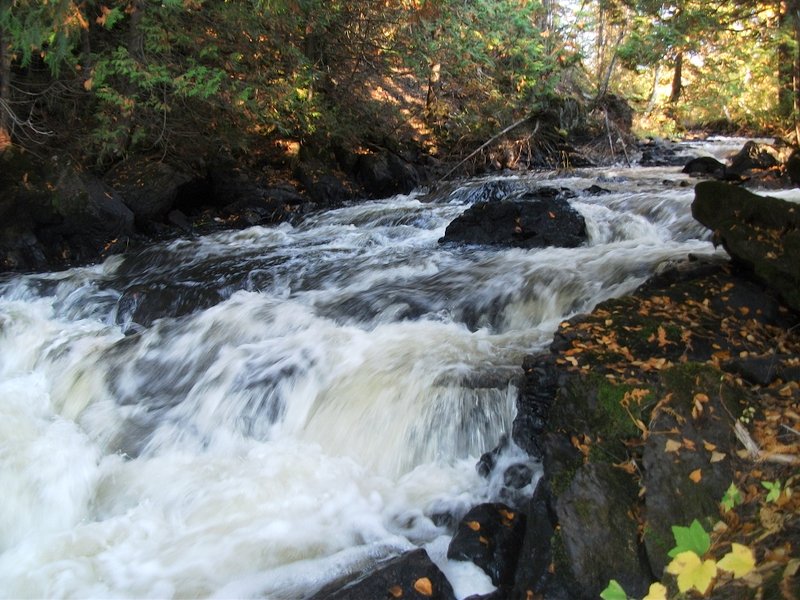
Just south of Bending, where the route enters Turtle River-White Otter Lake Provincial Park, two parallel waterways flow in opposite directions. Skilled paddlers can run six sets of Class 1 rapids heading north, round a point on Bending Lake, and paddle back south, and downstream on the Turtle River. If you really enjoy running easy rapids, a 600 m portage is all that stands between you and a second circuit!

Turtle River–White Otter Provincial Park sees more travelers than any other segment of the route. Highlights include some formidable rapids, pictographs, sandy beaches, the remnants of a prisoner-of-war camp and, of course, White Otter Castle, James McQuat’s renowned 1903 log cabin monument.
The water here is luminous

South of White Otter, Clearwater West Lake is aptly named. On calm sunny days, the water here is nothing short of luminous as light reflects upward from the sandy lake bottom, fifteen feet beneath your canoe.
You may spend days camping on one of its long sandy beaches—either by choice or because your progress on this large, open lake has been “put on hold” by north or west winds. But with convenient road access to Clearwater West, it’s easy to plan a strategic crossing when the winds are favourable.
Camp amongst tall pines on smooth rock outcrops
Like Clearwater, Turtle is another large lake with road access off of Highway 622 and opportunities for sandy beach camping. Moving east and south through Crowrock and Dashwa Lakes, you’ll get a 35 km vacation from portaging, but check the forecast and factor in some extra time in case you get wind-bound.
No worries, though: this neck of the woods is abundant in five-star campsites with smooth rock outcrops and tall pines. The Turtle/Crowrock/Dashwa chain offers excellent opportunities for kayaking, with road access and public landings at both ends.
Experience the Floatable Five
Eye Lake lies south of Dashwa, just across Highway 622. Island campsites at the south end are notable for their old-growth White Pine. The small lakes and narrow waterways between Eye Lake and Perch Lake may be best travelled with the (north to south) current.
Highlights include Eye Falls, mature White Pine forest, and “the Floatable Five,” a series of shallow rapids and pools that, under the right conditions, are fun to run or wade. There is also a short 850 m portage for those feet that would prefer to stay dry.
The secret waterfall
Between Perch Lake and the town of Atikokan, the Atikokan River meets the Seine River.
This segment is best traveled from east to west with the current. The same applies to the segment east of Atikokan, where you will find numerous sets of Class 1 rapids.
Cedar Falls is a spectacular secret, hidden in a dense cedar grove. The Atikokan River winds through wetland areas rich with wildlife. You may well see Trumpeter Swans, Bald Eagles, Moose and otters all in the same day.
Entry into Quetico
At Fire Lake, the Path of the Paddle crosses Highway 11 with a 3 km portage up the Nym Lake Road. Just south of Nym, the Path of the Paddle enters Quetico Provincial Park, the internationally acclaimed canoeing destination known to most North American paddlers, many of whom return annually.
With the participation of Quetico Provincial Park, and generous funding from the Trans Canada Trail Association, Ontario Power Generation, and Souris River Canoes, the Maukinak and Quetico Trail segments have recently been cleared of trees that came down during a devastating winter storm in October, 2017.
All portages are marked and in excellent condition. Maps of the Maukinak Trail, including portages, campsites and access points are available at www.pathofthepaddleassociation.com.
For trip planning, call Quetico Provincial Park at 807-597-2735, 9:00 a.m. – 12:00 p.m. and 1:00 p.m. – 4:00 p.m., Friday through Tuesday, from mid-May until mid-September.
Quetico Provincial Park is part of the Northwest Wilderness Quest.