Calling all teachers…
Ontario is one huge place. Most of us spend the majority of our time in one small section of the province.
But there is a vast expanse waiting to be explored.
We’ve partnered with Canadian Geographic for something big. GIANT, you could say.
We’re excited to unfold the Ontario Parks Giant Floor Map, and explore it with students across the province.
How giant is it really?
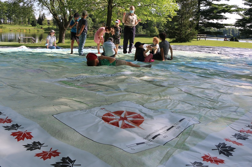
We aren’t exaggerating when we say the map is GIANT. Ten metres by ten metres, to be exact.
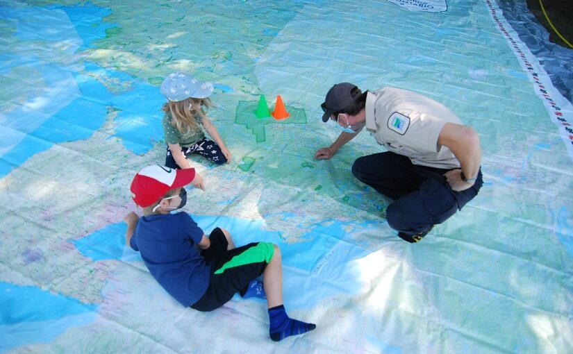
The size of the map makes it an impactful tool for teachers to educate students about their home province.
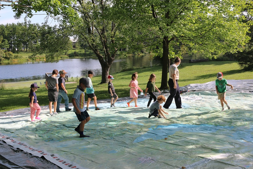
When children walk the perimeter of Ontario, they get a feel for just how big the province is, from the freshwater of the Great Lakes to the saltwater of Hudson Bay, where there is permafrost in the ground.
Traversing the map helps students visualize and explore. Ontario is large, and there’s much to see. Kids get to interact with their hometown, and discover new places to visit.
What’s on the Giant Floor Map?
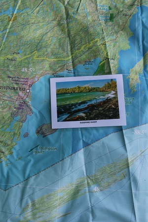
All Ontario provincial parks, plus lots more, including Indigenous treaty areas, highways, and rural and urban communities.
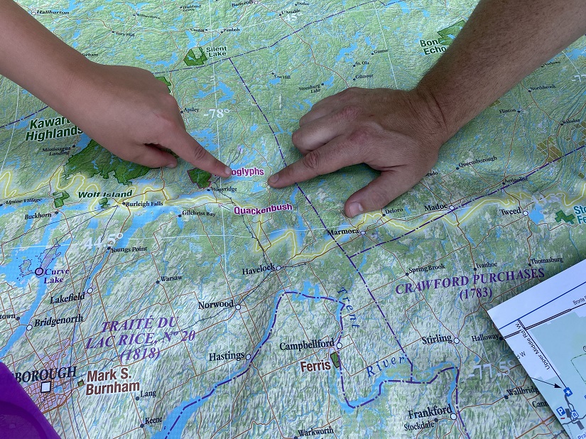
Dive into the different ecozones of Ontario, outlined in yellow. The province is divided into three main ecozones: the Hudson Bay Lowlands, the Ontario Shield, and the Mixedwood Plains. Each has very different features to see and learn about.
Did you know Ontario has Polar Bears in the north and cacti in the south? What an impressive range of life!
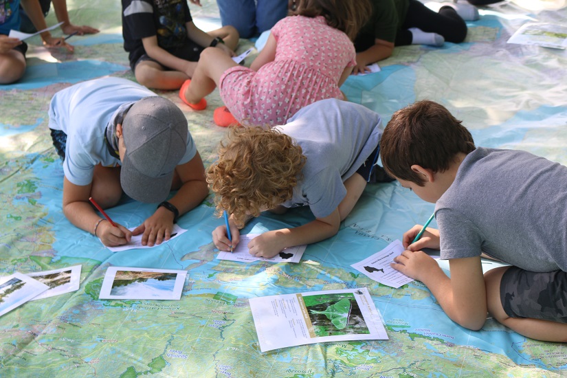
The biodiversity of Ontario is vast. Use the accompanying activities and cards to enhance your session on the map. For instance, take a look at the species profile cards to see some of the plants and animals that live in Ontario.
Become more acquainted with the Ontario Parks system. There are over 330 parks highlighted in green on the map. Challenging students to stand on the parks they’ve visited is a fun and engaging way to create a conversation about provincial parks.
What makes Ontario so special?
It’s vast and diverse!
Ontario has over 250,000 lakes, including the Great Lakes, which hold 20% of the world’s freshwater.
The Great Lakes are grand and powerful. They’re part of the largest freshwater system in the world.
To the north, Ontario touches the salt water of Hudson Bay. That’s where you’ll find the Hudson Bay Lowlands, the largest wetlands in Canada.
The boreal forest is one of the largest forests in the world, spanning across North America and Eurasia.
Much of Ontario is covered in this sea of spruce, pine, and other trees. Fifteen percent of Canada’s boreal forest is in Ontario.
In the southernmost reaches of Ontario, there are tracks of Carolinian forest. Unique trees grow in the south, like the Sassafras tree, which is found nowhere else in Canada.
What else can my class learn from the map?
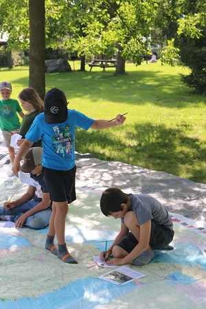
In addition to seeing for themselves just how big and amazing Ontario is, students will also learn to read a map.
Teach students to:
- identify a compass rose and find north
- read a legend
- use a scale bar
- find a location using longitude and latitude
For example, you might challenge your students to find the coordinates of their favourite provincial park.
Spatial concepts are easier to understand (and more fun!) when you can actually stand on the map.
Bring the map to your class!
Are you a teacher who thinks this would be a valuable and exciting experience for your students?
Book the map
The Ontario Parks Giant Floor Map is available for a three-week loan from Canadian Geographic. You can book the map online.
It comes in a standard-sized hockey bag, with bilingual teacher guides and teaching materials. Shipping fees apply.
Book the map AND an expert
Want to take your lesson to the next level? Book a Pinery or Bronte Creek Discovery leader!
Looking for a Discovery leader closer to your school? Inquire through our Discovery page!
Discovery staff are currently available to connect with your class virtually or outdoors, weather permitting, to help guide your students through an engaging educational program on the floor map.
The Discovery team are experts in the ins and outs of Ontario’s geography, biodiversity, and provincial parks. We’re passionate about the land of Ontario, and we are pumped to share our knowledge with your students.
Step through all of Ontario
Let’s travel to the west, hike over to the east, and stop to take a look at all the amazing parks in between.
We promise Ontario is full of wonders to uncover. Let’s find them together.

Ontario Parks thanks the Weston Family Foundation and the TD Friends of the Environment Foundation for supporting the creation of the Ontario Parks Giant Floor Map.
![]()
Board Director Emma Adamo said “The Ontario Parks Giant Floor Map is an innovative way to illustrate how big Ontario is and how massive its Northern regions are. Stories of our nature and history unfold as students discover the special landscapes and ecosystems that Ontario’s provincial parks represent. I am delighted that the map is getting out into schools and beneath the feet of Ontario’s students as they go back to class this fall.”