Park features on this map are representative only and may not accurately depict regulated park boundaries. For official map representation of provincial parks, visit Ontario's Crown Land Use Policy Atlas.
- Lake Superior
Park Office
Latitude: 47.722989
Longitude: -84.811803
- Lake Superior
Agawa Bay - Agawa Bay Campground
Latitude: 47.3357
Longitude: -84.615337
- Lake Superior
Cresent Lake - Crescent Lake Campground
Latitude: 47.276292
Longitude: -84.548239
- Lake Superior
Rabbit Blanket Lake - Rabbit Blanket Lake Campground
Latitude: 47.753297
Longitude: -84.825847
- Lake Superior
Old Woman Bay - Day Use Area
Latitude: 47.790313
Longitude: -84.89684
- Lake Superior
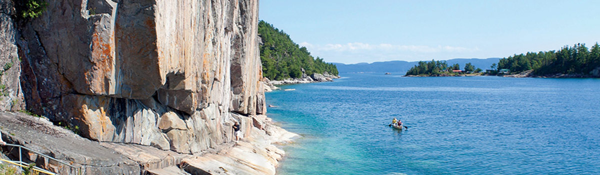
Agawa Rock Pictographs
Latitude: 47.369967
Longitude: -84.685643
- Lake Superior
Visitor Centre
Latitude: 47.347637
Longitude: -84.626752
Park Maps (pdf)
![]() - Lower Agawa River Canoe Route
- Lower Agawa River Canoe Route
![]() - Mijinemungshing Lake Canoe Route
- Mijinemungshing Lake Canoe Route