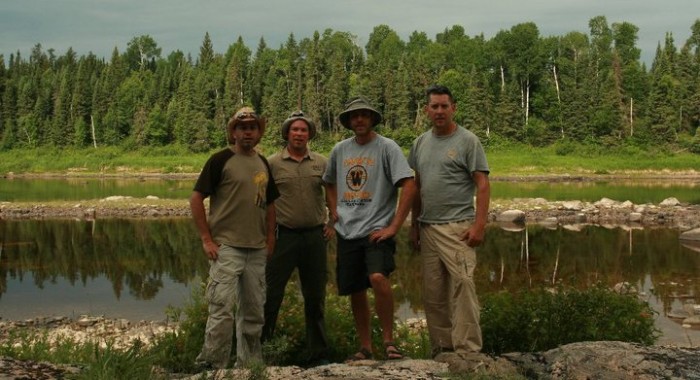
Backcountry-lover Scott Elliott, a Partnership Development Specialist from our main office, shares the story of his nine-day wilderness adventure.
Many parks are easily accessible; you just pack your tent and sleeping bag, hop in the car and roll into your weekend campground.
But some parks require planning, motivation, and a refined skill-set.
Missinaibi Provincial Park is one of those parks.
 The Missinaibi River is one of the most complete and diverse backcountry paddling experiences of any in Ontario Parks and — dare I say it? — the world.
This unbridled river stretches 500 km from the headwaters of Lake Missinaibi, flowing north to the conflux of the Mattagami and Moose Rivers, and onto the open waters of James Bay.
There are five different paddling routes, most prominently: Missinaibi Lake to Mattice (upper section) and Mattice to Moosonee (lower section). Access to both these paddling route are enhanced by rail and highway crossings which permit easy pick-up and drop-off points for paddlers.
Either section is a prime playground for the white water enthusiast.
We opted for the Mattice to Moosonee route, made our plans, and counted down to departure day.
Day 1
Our group of three guys travel from Ottawa to Cochrane where we pick up our fourth paddler and have a night’s rest before continuing west on Highway 11. We are traveling comfortably (for now) in a roomy Dodge Caravan pulling a small utility trailer.
 Our trailer is packed with two 17’ Royalex canoes, two food barrels, four packs, fishing gear, helmets, PFDs, paddles, spray decks for the boats, ropes, two copies of Hap Wilson’s “Journey to the Northern Sky,” two sets of maps, and one lightweight aluminum wok.
By nobody’s definition are we packed light, but we are prepared.
Day 2
We wake early and do a final check of all our gear. We stop for breakfast in Smooth Rock Falls, then on to Mattice where Highway 11 crosses the swift flow of the Missinaibi River. We are on the water by 11:00 am, and our shuttle driver is en route back to Cochrane with our van and trailer where it will await our arrival in eight days.
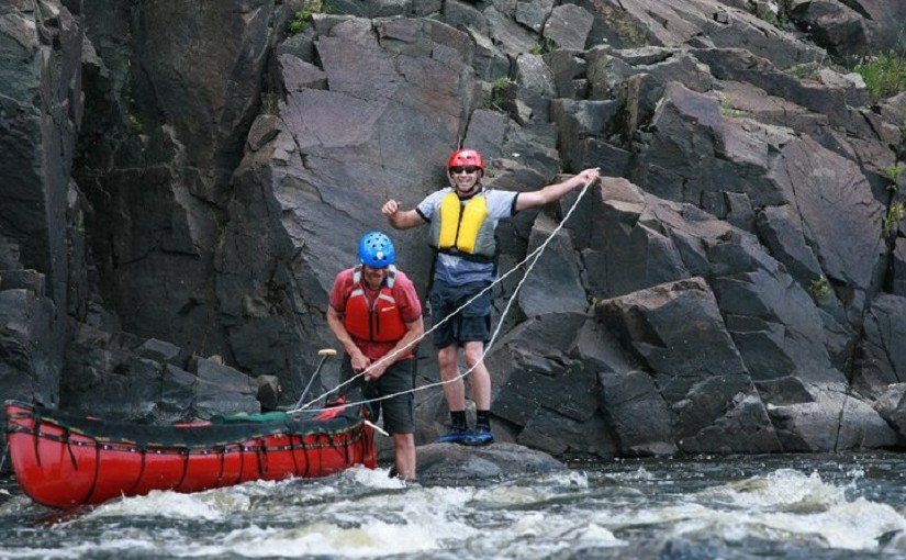
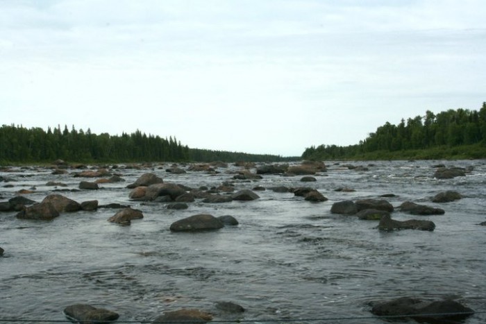
Water levels are extremely low; flow is fast, but with much lower volume. We’re only a couple kilometers into our journey when we encounter our first rapid – Rock Island Rapids. Our boats are heavy with gear, and this rapid is a rock garden.
We portage our gear down the centre island before taking the channel to the right of the island. The low water makes this a far more technical ride that it would normally be. We remained relatively dry (spray decks are a big help), reloaded gear, and continued on.
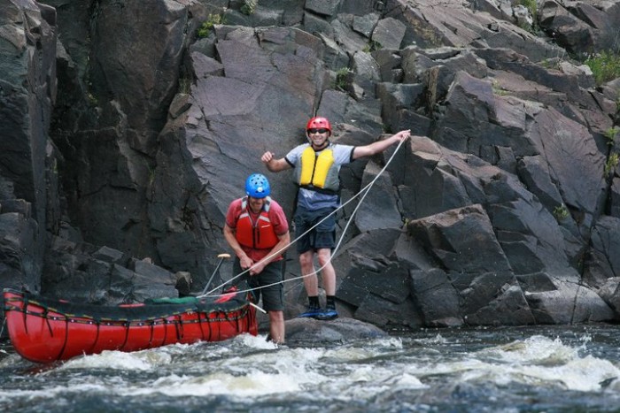
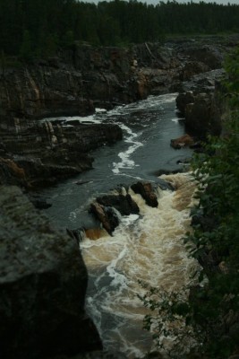
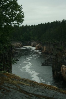
We are not long before reaching the next marked rapid/portage – Black Feather Rapids. This would prove to be a very miserable experience. This particular location happens to be home to the largest collection of rocks on the planet – or so it seems.
Easily the largest rock garden we could ever have imagined – it probably stretches for upwards of 1 km. The image below pretty much captures it – a look back upriver of the route we navigated. We never find the portage, which would have been helpful – probably because of the low water.
This 1 km stretch of river takes us about 4 hours to navigate/line/paddle. We are exhausted and set up camp on the bare rock shoreline of Black Feather.
Day 3
Looking for a little redemption from Day 2 – it was unanimous that the Missinaibi had gotten the better of us on the first day of paddling.
After a full breakfast, first up was Beam Rapids – a short, fun rapid which required only a little scouting to ensure safe passage. Paddling on, we reach Kettle Falls. A small drop, but nothing you’d venture over in a canoe. We take the 400 m portage around the drop and enjoy a great lunch spot below the falls.
With no other portages required for the day, we are on cruise control to reach Bare Rock Point for our second night camp.
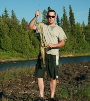
 Time for a little fishing break. First cast – SCORE!
It doesn’t take long to find a nice addition to our dinner table, but soon after that catch, we find the river topography changes right back to those miserable rock gardens.
In higher water, these rocky bottom structures are probably not even visible, and would appear only as swifts on the surface. But with water levels down several feet, our pace is slowed as we meander across the moving water between boulders the size of cars.
At one point – we watch a float plane buzz overhead following the river opposite our direction. This has been the only sign of other people we’ve seen.
By mid-afternoon, the flow of the river has increased – a sign we’re getting close to the Missinaibi’s feature attraction – Thunderhouse Falls.
Rather than pushing on, we agree to make camp at Bare Rock – a nice campsite with a natural rock harbour, and what look to be some great fishing spots. We are officially one day behind schedule — Bare Rock was planned as our first night’s camp.

We enjoy a good meal (including some fresh-caught fish!) before casting our lines into the evening flow of the river.
It’s UNREAL.
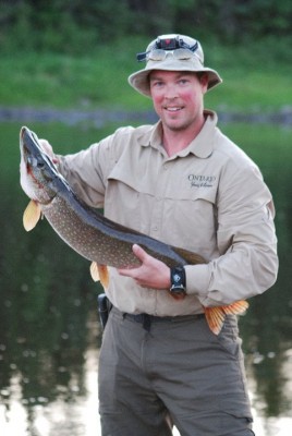 We fish for an hour or two, and keep enough pickerel for breakfast in the morning, have a trophy pike snap a line, and throw back plenty of nice fish. This is fishing like nothing we’ve experienced before.
We’ve evened the score with the Missiniabi, but we are also very aware that these small wins are all that we can hope for.
Day 4
A full breakfast of bacon, eggs, and pickerel is in order as we set out on the short paddle to reach Thunderhouse Falls. We are up early and on the water before 8:00 am. It’s a relatively short paddle to the take-out point on river left – which is very well marked.
 You don’t want to miss this takeout, and you don’t want to be on the wrong side of the river. There are multiple take-outs up the left side of the river, but each one further downriver adds an extra element of risk if you should happen to tip. With each take-out you pass, there are large CII & CIII rapids that can easily get you into trouble.
Our first boat smartly follows the first take-out, which adds a few hundred meters onto the portage. In total, the route around Thunderhouse is about 3 km along a well-maintained portage. Don’t forget to look for the diary and sign your name.
Our second boat opts to scout and run the first set of rapids above Thunderhouse in hopes of reaching the second takeout point.
Long story short: they get wet. They fill their boat with water and have to swim/line their boat out to the takeout. They don’t save themselves any time or effort, and are lucky not to lose their gear.
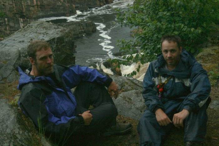
With everyone on firm ground, boats stored at the end of the portage, and camp set up, we spend our afternoon taking in Thunderhouse Falls and Conjuring House Rock, and exploring the portage trail that parallels the gorge.
The sunny days that have blessed us so far were coming to an end. Cooler temperatures and rain are on the way in.
Day 5
We wake to a light rain, much cooler temperatures and a bit of a head wind. Below Conjuring House Rock, we load back into our boats to make the short paddle to Hell’s Gate.
We weave through more rock gardens and land at the portage around Stone Rapids. The same trail and portage connects with the Hell’s Gate portage combining for an almost 5 km route around Stone Rapids and Hell’s Gate Canyon.
The canyon is a must-portage, but Stone Rapids are very doable at the water levels we’re paddling. The head wind makes these technical rapids more tedious than we would like, but it does save us carrying the canoe almost 1 km.
We opt to portage our gear the entire 5 km around Stone Rapids and Hell’s Gate, but paddle Stone Rapids and pull the canoes out only for the portage around Hell’s Gate Canyon.
This portage is relatively easy (as far as really long portages go) – except for the first 80 m and the last 80 m. Rope is helpful to get your canoe up and down these inclines – it’s very steep at both ends.
 We’d read about other trippers who experienced knee-deep mud and relentless bugs. The Missinaibi spares us from that misery. We move quickly through the portage and are on the water by mid-afternoon.
The afternoon offers a few sporadic clearings, but we know heavier rain is coming soon. The river continues as a series of long bends through more rock gardens. These rock gardens seem more forgiving, or perhaps our paddling techniques are improving? We have a blast running several long sets, one after another of CI & CII rapids before the river opens to a large bay – Bells’ Bay.
Our next campsite is on river left looking out over Bells’ Bay. For the first time on the trip, the landscape is not dominated by rock. Looking out across from our campsite are large clay bluffs. I guess these to rise at least 30 m above the river.
Day 6
With much of the river’s elevation changes behind us, and no remaining portages – it will be smooth sailing (literally) to the Moose River rail crossing.
But we still have almost 200 km to go.
We wake early to find the weather has turned on us. It is cold, very cold, and the rain is sleet. Toques, neoprene gloves, and full rain gear donned, we brew up some hot coffee, break camp and get paddling.
Fortunately, the swift current of the river carries us at almost 10 km/hour. Our steady movement keeps us warm, but we know it’s only a matter of time before the rain gear hits its threshold, and we start to get wet to the bottom layers. It’s that point in time when we will need to pull off the river and find a campsite.
We barely make the afternoon hours before we have to pull off. The temperatures have warmed up (hitting double digits), but the precipitation has not let up. It’s a steady downpour by the time we spot the campsite where we’ll hunker down for the night.
The campsite sits atop a steep clay bluff, 2-3 m above the sandy riverbank where we tie off our canoes. Our site consists of a small clearing cut into a soggy softwood forest – everything is wet. Accessing the site requires us to climb the muddy slope and tie off a rope at the top. Without the rope, we’d never have gotten all our gear up the slippery mud slope to the campsite.
The rain is relentless. We fashion two large tarps, build a fire, and settle on hot soup and coffee for dinner. We are well behind schedule with about 160 km to go and only three days.
We discuss our options: the plan was to reach the Moose River rail crossing by Friday afternoon, then catch the train back to Cochrane. Otherwise, we’ll be waiting until Sunday for the next train. We agree to turn in for the night, get a good night’s sleep and be up before sunrise to hit the water at first light.
Day 7
We wake to a new day – still dark, but no rain. Breakfast consists of coffee and oatmeal. With our tarps already unpacked, we decide to fashion sails and ride the winds to the Moose River. We are very much committed to catching this Friday train, so we are on the water as the sun came up.
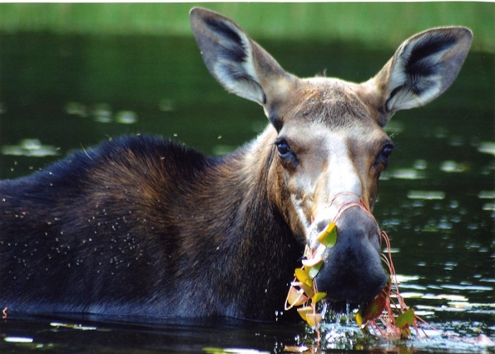
It isn’t long into our day of paddling before we see a large moose down at the water for a morning drink.
Thanks to the current of the river, combined with a consistent paddling stroke and a large blue tarp sail – we hit speeds of 14 km/hour. We make several stops for breaks to enjoy the solitude and scenery, and check out an old weather station and cabin on the river.
As we pull out from one of our shore breaks, a 3-4 foot-long sturgeon swims under the boat! It’s amazing to see this fish move so effortlessly through the clear brown waters.
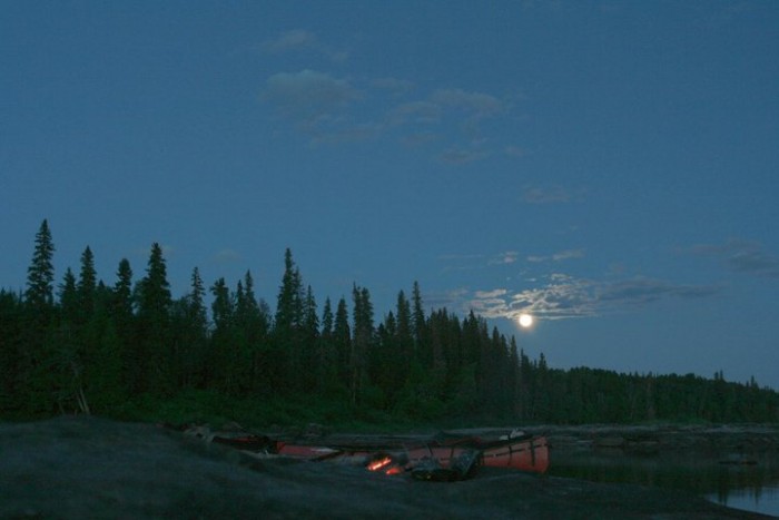
 We continue under warm sunny skies until the early evening hours and pitch our tents at the confluence of the Pivabiska River. A large sand spit will make for a comfortable night’s sleep. We trust that there are no significant increases in the water levels, or we could be in for a wet awakening.
Day 8
It’s another early morning pack-up under partial darkness and we’re on the water at first light. A little less than 100 km to cover in two days means that we’ve made some significant time back and should be able to reach our destination on time.
We plan to celebrate Canada Day this afternoon with a couple of beverages at camp, and hopefully some fresh fish. The river currents have not slowed significantly although the river has widened and the large boulder rock gardens have given way to the clay-and-bedrock sections that define the river.
However, there is still significant meandering of the river through rock channels, which often funnel currents back upriver — a very interesting phenomenon. When making our channel selections and reading the river currents and channel depths, our motto is, “Follow the bubbles.” The bubbling froth of the river always follows the main channel flow.
 After about 60 km, we land on a level grassy bank of the river that will be our campsite. Getting into shore is the biggest challenge – the shore edges are a series of channels separated by rock.
We make camp, then hop back into the now-empty canoes to try some fishing. Not surprisingly – we catch fish immediately out in the main channel and have a feed of pickerel for dinner.
This was to be our last night on the river.
Day 9
We wake to another beautiful day and 40 km of pristine river guiding our return home via the Polar Bear Express from the Moose River rail crossing. We paddle the last few kilometres of the Missiniaibi River, taking it all in.
At the confluence of the Missinaibi and Mattagami Rivers, where the Moose River forms, we enjoy a great ride through the voluminous waves created by the two large rivers’ meeting.
Initially, the low water around Portage Island gives us the impression that we’ve reached a dead end. We float to the right of the Portage Island on just a few inches of water, meandering through shallow channels until we find the big flow where the two rivers formed the Moose.
The standing waves are huge! To safely join the flow, we actually have to paddle back upriver to access the flow of the Mattagami and ride that current into the large standing waves created at the confluence of the two rivers. This would prove to be our last big water ride of the trip – and it was a fun ride!
We paddle for a few hours on the Moose River, noticing the width expanding at each bend. The river is wider, but shallow. We soon see a familiar iron structure – this must be the Moose River rail crossing.
We paddle to the shore under the bridge and find a well-beaten path up a very steep embankment. Our journey is all but complete.

We slug our gear and canoes up the path where we line the rail tracks and await the late afternoon train from Moosenee to Cochrane.
The train arrives on schedule and our gear is loaded onto an empty box car. We board the train and head directly to the diner car to enjoy some cold beverages and comfort food. I have to admit – this is a pretty nice way to finish a trip.
We watch the scenery until our eyelids no-longer cooperate, and wake at the train station in Cochrane where our vehicle awaits us.
This will remain as one of the most memorable experiences of my lifetime
A unique combination of camaraderie, relaxation, perseverance, solitude, bewilderment and sense of accomplishment define what it is to experience some of nature’s most pristine and inaccessible places.
Where will you venture to?